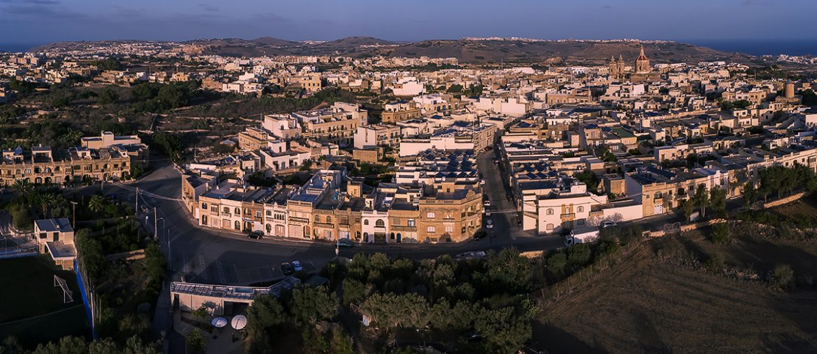
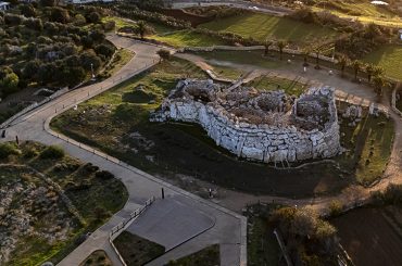
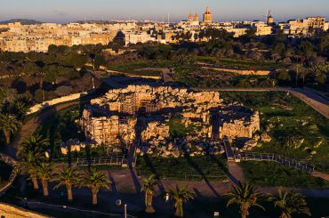
Four months after UNESCO requested a report in 2015 into how changes in planning policies would protect World Heritage Sites “from the adverse impact of future development,” the Maltese government approved policies to raise heights and density of buildings near the same sites, research by this website can reveal.
And in the past month, two developments of a density and height that would not have been possible prior to the policy change in 2015 have now been approved in the buffer zone of Ggantija Temples.
This website's research can also show that UNESCO’s World Heritage Committee (the decision-making body on World Heritage Sites) had made two requests. In the first, in 2014, it requested that Malta “informs” the committee of any development proposals in the buffer zone to enable the Committee to “assist in seeking appropriate solutions to ensure that the Outstanding Universal Value of the property is fully preserved.”
A year later, in July 2015, the Committee in its annual meeting held in Germany approved an extension of the buffer zone around Ggantija. It then requested that Malta submits a report on review of the Local Plan that would “explain how the UNESCO World Heritage properties and sites on the World Heritage Tentative List and their viewsheds are protected from the adverse impact of future development, for examination by the World Heritage Centre and ICOMOS.”

Four months later, on 3 November 2015, the Maltese government approved a new policy document called Development Control Design Policy, Guidance and Standards 2015 (DC15 for short). It redefined development height limitations from number of floors to height in metres. At around the same time the government enacted a sanity law that allowed internal floor heights to be as low as 2.6 metres. This created two things: greater stacking of floors within height limitations, and overall higher buildings permitted.
What this means in real terms can be illustrated by the permit granted for 22 flats and 20 garages two weeks ago in the Ggantija buffer zone. Prior to the change in policy, a development would have been limited to two floors and a three course basement – an overall height of less than 8 metres. Under the new policy, a development of four floors at a height of up to 12 metres became possible. The permit granted two weeks ago is for four floors (it is not possible to ascertain precisely its overall height because the height in metres is not shown in the architectural drawings.)

As already point out, UNESCO’s World Heritage Committee had made the request for information on how changes in Local Plan would protect the buffer zone after approving an extension of the buffer zone around Ggantija Temples. The request was made in the context of ICOMOS having noted that no “management arrangements” were in place to protect the buffer zone, and then raised concern about the potential impact of development in the buffer zone.
ICOMOS stands for the International Council on Monuments and Sites, an NGO that advises the Committee. Malta’s branch of ICOMOS last week issued a press statement outlining some of the points mentioned in this article – this website’s research being published in this article is expanding on the details or findings put in ICOMOS’s press statement.
A review of the Local Plan has been promised for many years, at least since 2012. At one point it got underway, but the exercise has since stalled or petered out.
In recent months, however, the government has initiated set-piece or spot amendments of the Local Plan for two specific areas: Marsascala (where the amendment shall remove the provisions for development of a yacht marina from the bay), and Hondoq Ir-Rummien (where the amendment would remove provisions for tourism development).
In the case of the Ggantija buffer zone, the Planning Authority has not only granted denser, higher buildings than would have otherwise been permitted prior to 2015, it has now also twice misrepresented the extent of the buffer zone. In the two cases in which it granted permits for four-storey blocks of flats in the past month, Planning Authority officials insisted wrongly in hearings when the developments were approved that the sites did not fall within the buffer zone. These officials appear to have based their claims on the Planning Authority's online map, which shows the smallish buffer zone of 1994 as well as the larger, latest buffer zone (also called the Area of Archeological Importance) of 2015.


