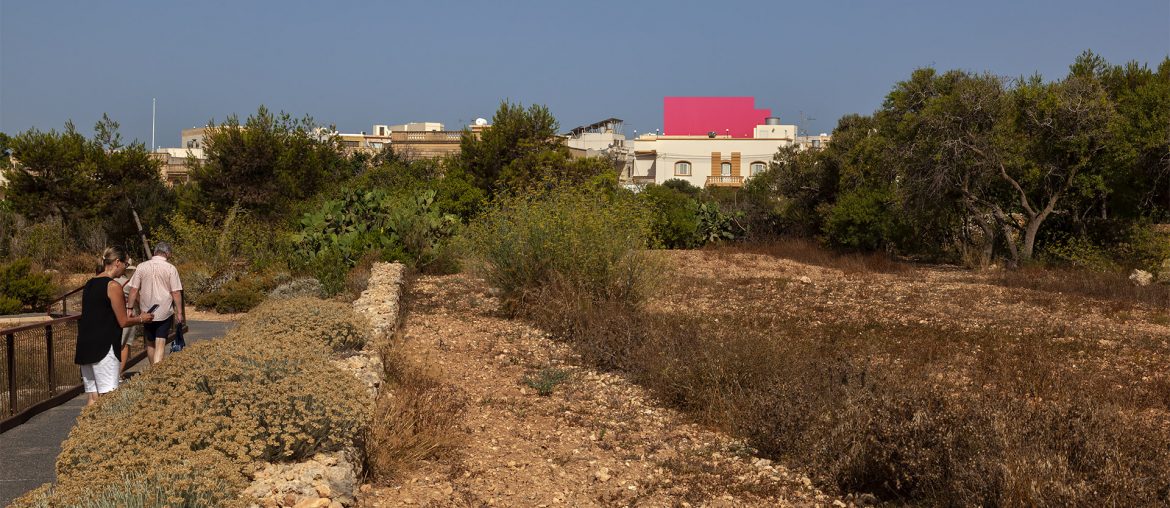
A photomontage of a proposed five-storey block of flats situated within the buffer zone of Ggantija Temples shows the proposed building substantially smaller than its true size, an investigation by this website can reveal.
The photomontage was prepared as part of the development application submissions to enable the Planning Authority, as well as the Superintendence of Cultural Heritage, to assess the proposed building’s impact on views and vistas of the Neolithic temples, which are among Malta’s most popular and a World Heritage Site.
The misleading photomontage shows the proposed block only rising marginally above a two-storey townhouse as seen from the temples. This led to the Superintendence of Cultural Heritage and Heritage Malta to write in a letter to the Planning Authority that the “photo-montages indicate that the proposed development will have a relatively limited impact on the values of the scheduled cultural heritage assets in the vicinity.”
Although the Superintendence and Heritage Malta then also “nevertheless” expressed “concern” that approval would lead to a “domino effect” of other similar developments, the Superintendent’s take of “relatively limited impact” clears a major hurdle for the planning application.
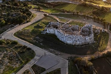
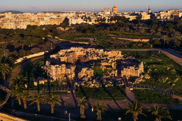
A render of the proposed development prepared by this website shows the scale of the building as seen from the temples more realistically – see slider images below.
In its investigations, this website also found that the photomontages were initially omitted from the Planning Authority’s E-Applications system, which is open to public viewing or access.
On 21 February 2023 this website then wrote to the Planning Authority requesting copies of the photomontages. The Planning Authority never replied to the email but two of the photomontages were then put up on the system a few days later. An additional two were uploaded just two weeks ago.

A map showing the locations where pictures were taken from – requested by the Superintendence – still does not appear on the Planning Authority's system.
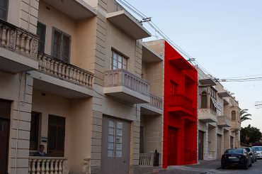
The proposed 5-storey block of flats is located at a neighbourhood that largely consists of traditionally Baroque two-storey townhouses, and which falls within the buffer zone – or, as officially known, the Area of Archeological Influence – of Ggantija Temples.

The area holds some of Malta’s most famous heritage sites. Aside from Ggantija Temples, there is also the Xaghra Circle – an underground Neolithic burial site or shrine – and Ta Kola Windmill, Malta’s most popular windmill.
There are currently five applications for blocks of flats in the neighbourhood. This website has been running a special reporting project, called Ggantija Streetscapes, on the threats these proposals pose to the neighbourhood and settings of the top heritage sites.
One of the proposed blocks of flats is situated just 30 metres from the windmill.
The Chamber of Architects (Kamra tal-Periti), which has a regulatory role over architects, last February published a directive to architects about development proposals that fall in the buffer zone of Neolithic temples. The directive stipulates that architects “must ensure that the height, bulk, and massing of the development are in proportion to the surrounding environment and do not negatively impact the visual, physical, or environmental integrity of the site and the surrounding landscape.”

After the Chamber published the directive, this website wrote to the architect who submitted the application for the five-storey block of flats (which is the subject of this article) to ask if she would be amending the proposal to be in conformity with the Chamber’s directive. This week, this website wrote to the architect, Cornelia Tabone, a second time to request comment on the misleading photomontage. Tabone did not reply to any of the two emails.

As already pointed out, the Superintendence of Cultural Heritage and Heritage Malta said that the “photomontages indicate” that the proposal would have “relatively limited impact”, yet they also expressed concern that “the approval of this application will lead to a domino effect [of other similar developments] creating a significant impact on views and vistas as seen from the important cultural heritage sites of Ggantija, Il-Mithna Ta Kola and Xaghra Circle.”
Donate to Ggantija Streetscapes
It has taken considerable time and effort to produce the renders of the proposed building published in this article. Moreover, it has taken a cumulative amount of time running into weeks to produce the reportage of the Ggantija Streetscapes investigative series published on this website. This website relies on donations for its income. Donate as little as €5 to sustain this reporting project, which serves to reveal and become a rallying point – all to save the streetscapes of the sensitive neighbourhood that form an integral part of the setting of Ggantija Temples.


