The Planning Authority has been granting permits largely heedless of policies designed to protect the skyline of scheduled buildings as well as Urban Conservation Areas, which form the historical cores of towns and villages.
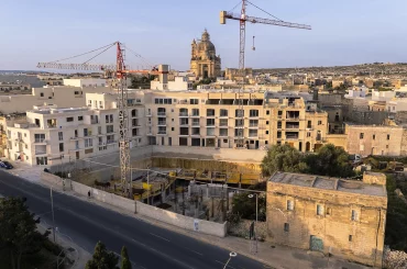
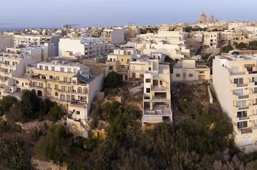
Among the development permits investigated by this website in which a key policy remained unconsidered is the five-storey block of 17 studio flats in Paola that has been in the news over the past two weeks. The Paola Local Council said in a statement last Thursday that it shall attempt to get the permit revoked.

The applicable policy, which was not considered, underpins the context-driven approach to developments in historic zones in the policy document known as DC15 (Development Control Design Policy, Guidance and Standards 2015). It is illustrated with three drawings in Figure 18 of DC15.
In a separate case investigated by this website, involving a development of a four-storey block of flats in Pieta, the Planning Commission as well as the planning tribunal both denied the primacy of the policy that regulates height in Urban Conservation Areas. This led the Court of Appeal to revoke the development permit twice.

In the Paola case, no consideration was given to policy P6, which is illustrated by one of the figures in Figure 18. This policy states that developments that are contiguous to zones designated as Urban Conservation Areas have to adhere to “transition solutions”, which is that the height of buildings would not be higher than the existing buildings facing the Urban Conservation Area.

A related policy holds that buildings within Urban Conservation Areas have to conform with existing heights, and that an additional setback floor may be considered (especially in cases where there are existing buildings on roofs such as washrooms) after assessing the impact on the skyline. To this end, the applicant or architect is required to prepare photomontages of long-distance views.
No photomontages of long-distance views were submitted in the Paola case. Yet neither the Planning Directorate nor the Planning Commission inquired into this or requested such photomontages.
This suggests that the Planning Commission took the decision on the case – permitting a floor higher than generally permitted in policies – without having full information as required by policies.
And the Superintendence of Cultural Heritage, a statutory consultee in development applications, merely “noted” in its assessment “that the proposed higher volume is contained to the footprint outside the UCA”, adding that it was “not averse to the proposed volumes outside of the UCA.” In this way, the position of the cultural heritage guardian in a development in a street in the historic part of Paola – described by the Local Council as one of the best-preserved traditional street – was less stringent than planning policies.

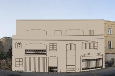
The building now given permit straddles a narrow block, rising from two storeys on the UCA side of the block to five storeys on the other street. Analysis of the architectural drawings shows that parts of the block that falls within the UCA is a floor higher than permitted in policy for UCA height, and the part that falls immediately beyond the UCA is also a floor higher than permitted by P6, the “transition solutions” policy.

The same Planning Commission for UCA also delivered in recent months another permit to a row of houses in the UCA in Nadur without having full information as required by policies. These four houses all featured so-called ‘roof structures’ that span each of the houses, as well small swimming pools on the roof. The policy states that in proposals for “roof structures”, then “photos showing the all round views from the roof are to be submitted.” No such imagery was prepared or submitted.
The Nadur development is part of a sprawling development, put together incrementally in four development applications, that belongs to the property developer Joseph Portelli and his partners, as well as Maryanne and Anthony Cauchi. The Cauchi’s co-own two farmhouses with Agriculture Minister Anton Refalo, and are also involved in the development of a seven-storey block of flats in Xlendi together with Refalo and the family of the PN’s spokesperson for Gozo, Alex Borg.
In a previous permit in the same Nadur project, the Planning Commission approved an application despite the Planning Directorate’s warnings that it would result in a blank party wall, which is in breach of policy. The Planning Commission imposed a “stepping down effect” and delivered permit – the finished building now features a blank wall of around three storeys high over the Urban Conservation Area.

The policy that holds that buildings immediately contiguous to UCA zones cannot be build higher than the row of buildings facing the UCA also applies to development applications within the context and setting of scheduled historic buildings. This is enshrined in Planning Circular 3/20 published, published on 25 May 2020, which talks about P6 – the transition solutions policy – as one of the policies that “can be applied to scheduled buildings and their context.” The policy also defines “immediately contiguous” as any proposed development sites that lie within the context as defined by Figure 18.
Yet in the case of Tal-Bwier Windmill, where six residents have filed an appeal against a four-storey block of flats, the Planning Commission delivered permit for four-storey block of flats that falls in the scheduled setting of the windmill and within a stretch of street of two-storey townhouses.

And in the case of another proposed four-storey block of flats situated just 30 metres from Ta Kola Windmill, within the scheduled setting, there is no mention of such policies and Figure 18 – let alone any assessment of such – in the Planning Directorate’s report. The directorate instead tried to justify the recommendation of approval by falsely or incorrectly asserting that the proposal is situated in a “piazza” of building with different heights when in fact all the buildings are two storeys.
In the face of widespread public opposition, the Planning Board still asked the applicant to reduce height and tweak the design of the façade. It then said in a press statement that although the proposal was “well below the maximum height limitation” and “would not have a significant impact on the windmill”, the board was being ‘vigilant’ to avert blank walls.
No mention was made of the policy intended to protect the skyline of buildings in settings of scheduled monuments.
Donate to Planning Emergency
The investigative articles in the Planning Emergency series published on this website take time, resources, and effort to put together. These articles make an impact by the robustness of the research and the professionalism of the reportage. Your support is needed to sustain this kind of impactful reportage. Eight articles within the Planning Emergency series have been published on this website since the beginning of the year, but not even a penny raised from donations at time of publishing this article. Give heart and sustenance by donating as little as €5.
This is the first of a new investigative set (articles on this website and social media, short videos) of the Planning Emergency series that will be published over the upcoming week.


