The Planning Authority granted permit for an imposing block of flats after it cut short consultation with the Superintendence of Cultural Heritage over safeguarding a historical cave, and then further justified the permit by drawing dubious or false comparison on "massing" with a neighbouring building, an investigation by this website can reveal.
The dubious or false comparison on "massing" with the neighbouring block has only become evident now that construction of the block of flats has neared completion.
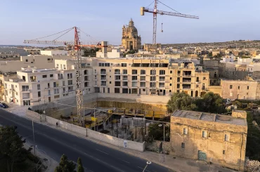
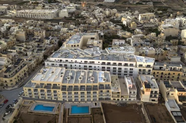
At seven storeys high, the block of 25 flats is the highest and most dominant along the entire ridge.

The building belongs to property magnate Joseph Portelli and his associates, including Mark Agius, the applicant.
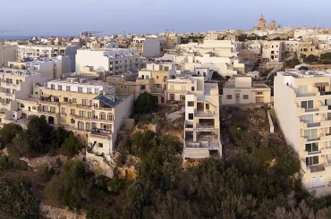
This block – together with a second 6-storey hulk 70 metres up the road granted permits incrementally, belonging to a different developer – have had a marked effect on the skyline, and gouged out the inland cliff, the first time this has happened along this ridge. This now risks becoming a pattern for taller, bulkier, cliff-gouging blocks of flats on inland cliffs that are described as a “very sensitive area” in the Gozo local plan.
The Superintendence of Cultural Heritage made this point in its submission to the Planning Authority. It opposed Portelli's initial proposal for 19-flat block due to “its scale and intensity”, appealing to the Planning Authority to observe policies designed to protect cliff-edges and development-zone edges. It also drew attention to the cave on site.
Superintendence officials then inspected the cave and found that it was a natural cave that had been adapted for human use over the years. The cave "branches off into a corridor, under a third-party property, that was likely used as a wartime shelter."
The Superintendence said that this is “evidence of the historical interaction between human activity and the cultural landscape that must not be eradicated by any construction approved on site.”
It then called for revision of the proposed development “in order to preserve this feature [cave] and retain its relationship with its setting overlooking the valley.” It also asked for a Work Method Statement – subject to its (the Superintendence) approval – to achieve this end.
But the Planning Commission adopted the Work Method Statement without consulting the Superintendence, or seeking its approval. The commission justified this by saying that the method statement is an “approved document with a bank guarantee of 5000 euro for the cave’s safeguarding and its retention and therefore no consultation with the Superintendence is necessary.”
Yet the method statement approved by the Planning Authority actually cocooned the cave within the overlying block of flats, something that does not exactly “retain its relationship with its setting overlooking the valley” as the Superintendence had requested.
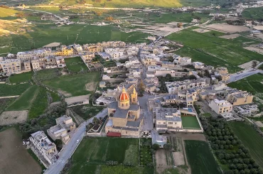
Click on any of the three images below to enlarge and view in sequence
The commission also justified the permit by saying that there is an “adjacent permit for the same massing" – massing is planning term for scale, density, and dominance.

Mark Agius, the applicant, then put in a second application for 6 flats, which connected to the earlier development, expanding the project to a hulk of 25 flats.
The Planning Authority then assessed this second application "on the same principles as approved" in the adjoining part of the block. In plainer English, it used the precedent set to grant the adjoining permit to permit an expansion of the block, in the process permitting an even larger and more imposing building on the sensitive cliff-edge location.


