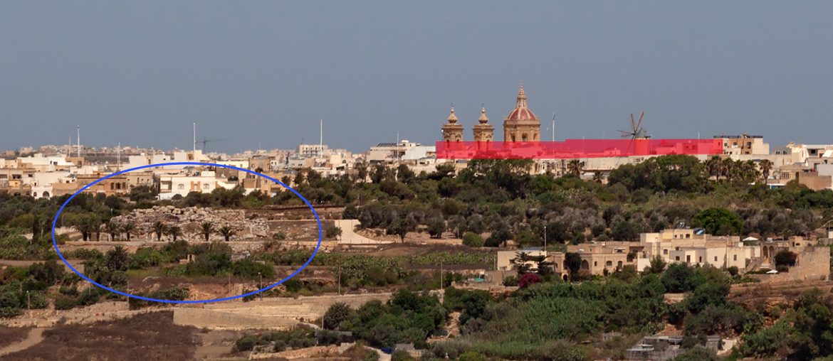
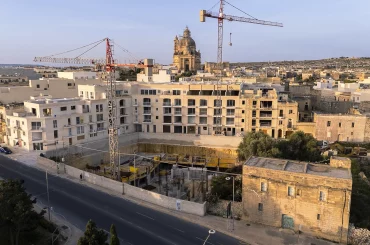
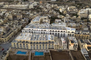
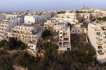
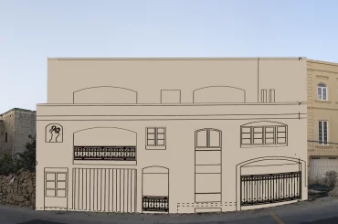
The application for a block of flats that threatens to mar the setting of Ta Kola Windmill, Malta’s most popular windmill, and set a precedent for a neighbourhood that currently consists of two-storey townhouses, has been assigned to the Planning Board meeting tomorrow. This means that the Planning Authority is attaching great importance to this case – hence escalating the case from the Planning Commission to the Planning Board, the Planning Authority’s highest decision-making board.
The Planning Board now has to grapple with a case officer report that has recommended approval for the proposed block of four-storey flats, which is situated on the street that leads from Ggantija Temples to Ta Kola Windmill.

An investigation by this website has already shown that the Superintendence of Cultural Heritage has made inconsistent assessments in two separate applications near the windmill. The Superintendence opposed a proposed building further away from the windmill due to visual impact on the windmill last year, but this summer it gave its blessing to the proposed building – the one set to be heard tomorrow – that is of same height and larger massing and situated closer to the windmill and the temples.
That same inconsistency has now repeated itself in the case officer’s recommendation for approval. The inconsistency is all the more stark given the Planning Authority’s spirited defence of its refusal of the other application last year.
In submissions in front of the planning tribunal in the earlier case – the case is in front of the tribunal after the applicant appealed last year – the authority has been defending itself by making two points. First, the impact on the setting of the windmill. Second, it asserted that the buildings in the street “all have a particular rhythm that is also reflected in the streets that form part of the scheme” – this is a reference to the neighbourhood of two-storey townhouses that were part of a 1970s housing scheme. Then it said that the proposal “departed from this rhythm and due to this it did not deserve to be favourably considered.”
Yet in the case nearer to the windmill set to be heard tomorrow, the block of flats makes a more significant departure from the streetscape or rhythm (to use the Planning Authority’s word) in the street it is situated in. And it is closer to the windmill, within its scheduled setting, with an arguably greater visual impact.
In the analysis on the proposed building’s contextual setting, the case officer predicated much of the reasoning on the photomontages and streetscape elevation analysis presented by the architect, Gordon Vella. (As previously reported in this website, the photomontage of the most crucial viewpoint along the street the proposed building is situated on does not actually show anything.)

The case officer wrote that the “proposed development respects the provisions of circular 3/20, especially since the overall height is not exceeding [sic] the heights of the buildings closer to the windmill.”
Circular 3/20, published in May of 2020, set more stringent standards for developments near heritage buildings, and it specifically address precedents. It specifies: “The effects of recent commitments [recent permits granted nearby] should be mitigated for rather than further marred, towards the improvement of the overall context of the scheduled building.”
Moreover, the case officer makes these interpretations on the basis of the streetscape analysis – presented by the applicant’s architect – that shows buildings down an adjoining street on the same plane. Although one of those buildings may indeed be technically higher, it is in an adjoining down-sloping street – and the perspective of that building from the street that holds the proposed building and the windmill is of the building in the adjoining street receding away and seemingly lower.
Asked about this, the architect, Gordon Vella, replied: “All buildings shown in the streetscape elevation were all taken in relation to the square [in front of the windmill] and therefore the overall building heights of the properties is higher when measured from the top of the building to their pavement.”
It is not clear whether Vella’s answer says the same thing or something different.

There is something else: one of the buildings shown in the streetscape elevation has rooms build without a permit. According to the Planning Authority, which has an “active” enforcement case, these are “rooms without a permit on all levels of the building”. This was not mentioned in the case officer’s report.
Separately, the proposed building also has a deeper footprint than 30 metres, which jars with policy P27 of the policy document known as DC15. The case officer addressed this by saying that the “built footprint is generally in line with Policy P27 of DC 2015 except for the proposed reservoir at basement level to store and reuse runoff water, which extends beyond the thirty metres.” Then the case officer references two architectural drawings. Yet those drawings appear to show that beyond the thirty-metre point from the street there is not just a water reservoir, there is also a swimming pool and its decking area around it.
UPDATE 10/11/2022: After making oral submissions in front of the Planning Board today, in which I shared the findings of this article, the Planning Board has deferred the case for further consultations and inquiries/analysis. Editorial note by Victor Borg
Donate to Ggantija Streetscapes
It takes much resources, time, and effort to do the research and digital renditions to produce the reportage of the Ggantija Streetscapes investigative reporting project published on this website. This website relies on donations for its income. Sustain this reporting project, which shall serve to reveal and, equally importantly, rally support for efforts to save the streetscapes of the sensitive neighbourhood that forms an integral part of the setting of Ggantija Temples. Donate as little as €5.

